Topography / Digital Elevation Model (DEM) Map
The Shuttle Radar Topography Mission (SRTM) was flown aboard the space shuttle Endeavour February 11-22, 2000. The National Aeronautics and Space Administration (NASA) and the National Geospatial-Intelligence Agency (NGA) participated in an international project to acquire radar data which were used to create the first near-global set of land elevations. SRTM 1 Arc-Second Global elevation data offer worldwide coverage of void filled data at a resolution of 1 arc-second (30 meters) and provide open distribution of this high-resolution global data set.
 Map.png)
Source: The surface soil map has been collected from India Water Resources Information System. https://indiawris.gov.in/wris/#/soil
Tags
Drainage Density Map Drainage Network Map Geological Map - Formation Geological Map - Lithology Geomorphological Map Groundwater Flow Direction (Pre-Monsoon) Groundwater Flow Direction (Post-Monsoon) GroundWater Fluctuation Map v2 Landform Classification Map v2 LandUseLandCoverMap 2011 LandUseLandCoverMap 2021 LULC Map for Year 2011 and 2021 River and Lake Link Map Satellite Imagery Map 2011 Satellite Imagery Map 2021 Soil Map v2 Unconfined Aquifer Map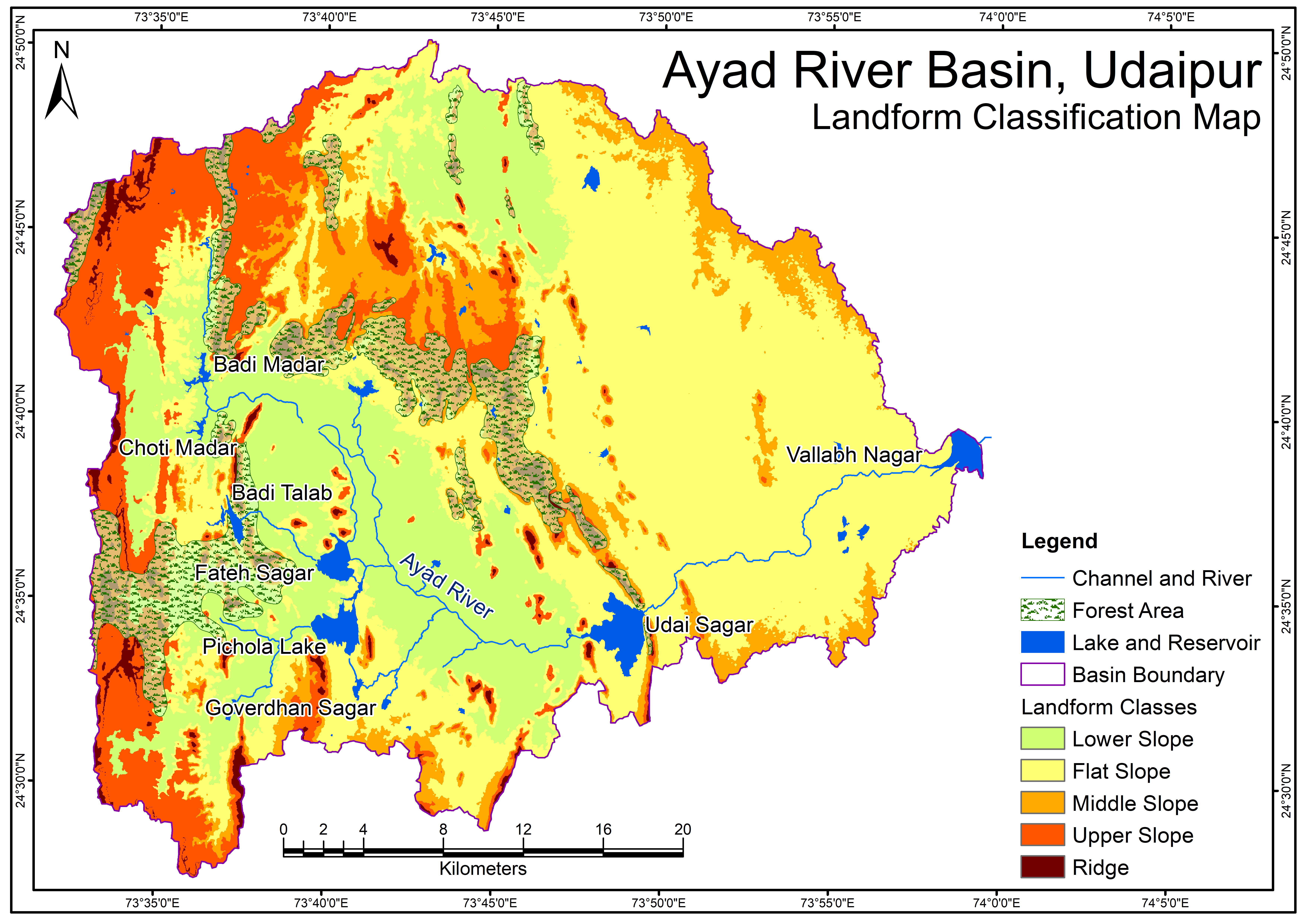
Related images
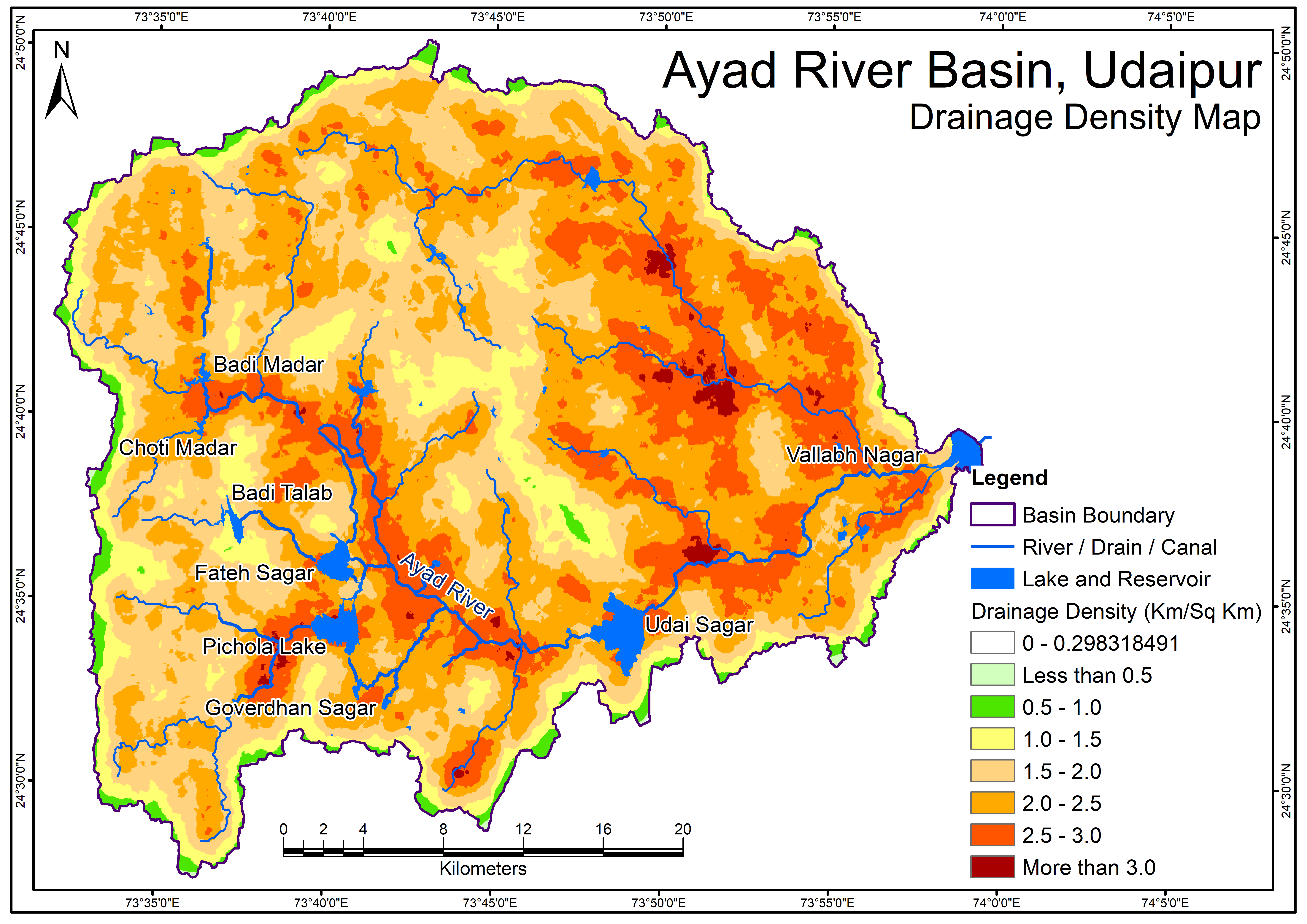
Drainage Density Map
View more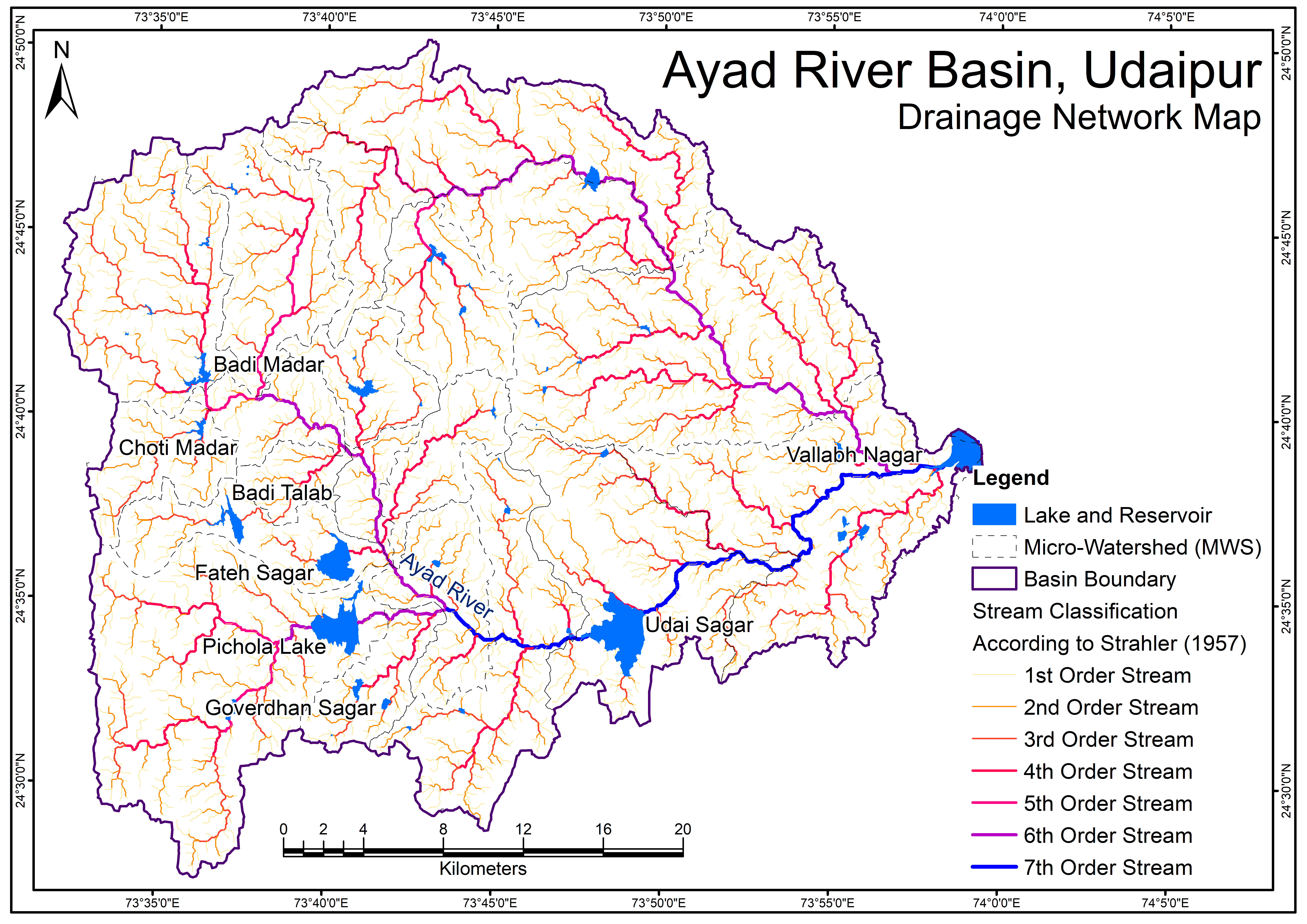
Perfumes
Drainage Network Map
Geological Map - Formation
View more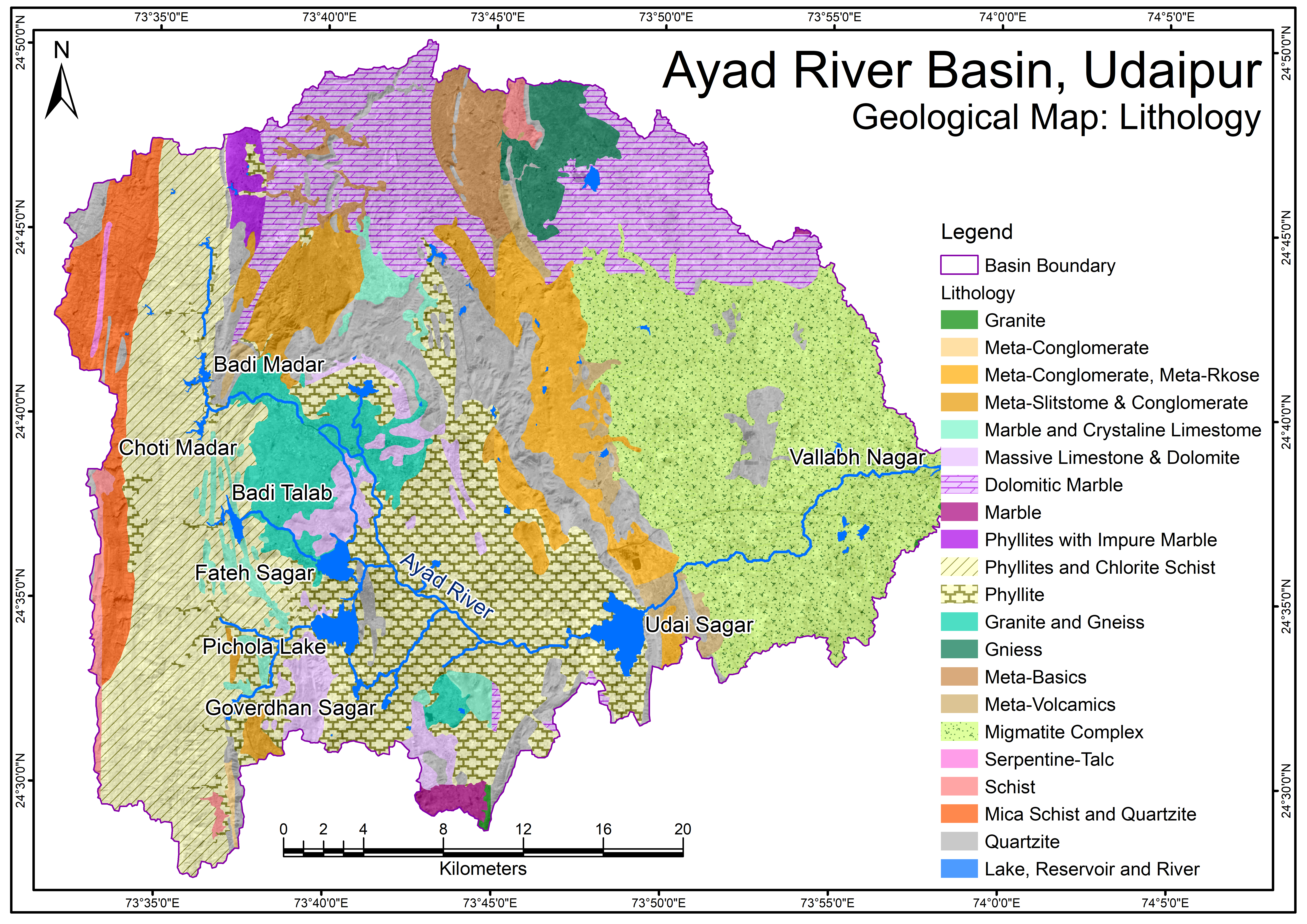
Geological Map - Lithology.png
View more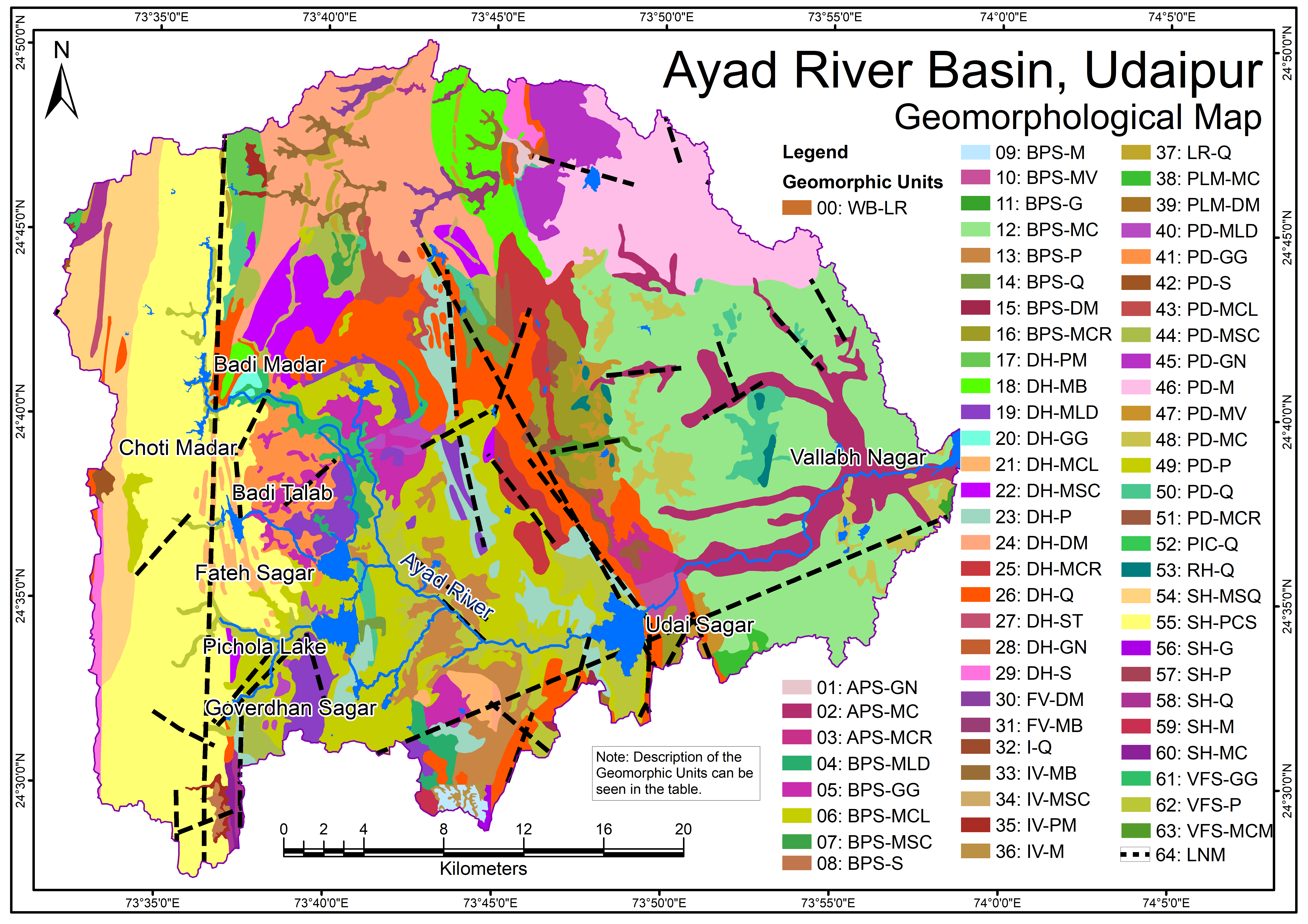
Geomorphological Map
View more.png)
Groundwater Flow Direction (Pre-Monsoon)
View more.png)
Groundwater Flow Direction (Post-Monsoon)
View more